

Cruisin’ Together
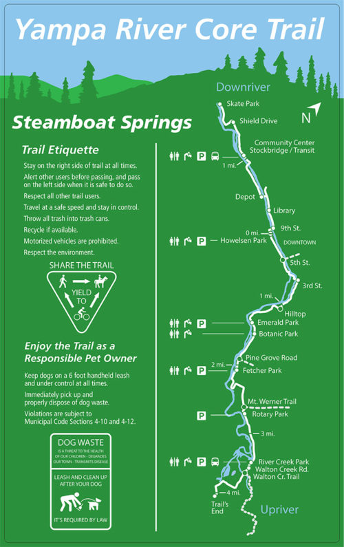
The Yampa River Core Trail is a 7.5 mile paved multi-use trail that runs next to the Yampa River. You can safely cruise on from the mountain all the way to the West End of town, enjoying the various sites along the way! Look for way finding signage along the trail for helpful links to other family friendly dirt and paved routes throughout town. Bike lanes also abound to help you navigate about town. Remember that the Core Trail is used by a variety of users, so have fun and respect others by announcing your presence when passing and obey speed limits.
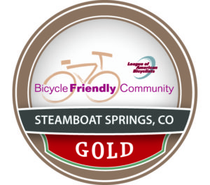
Steamboat is a Gold Level Bicycle Friendly Community
The League pf American Bicyclists recognizes Steamboat as a Gold Level Bicycle Friendly Community. Steamboat welcomes cyclists with trails, bike lanes, share the road campaigns, organized rides, Bike to Work Day events and so much more. The League reviews communities on specific criteria that recognize an area’s unique bike-oriented resources. They evaluate how the community encourages people to bike for transportation and recreation through the five Es: engineering, education, encouragement, enforcement, and evaluation. Steamboat has been recognized at the Gold Level since 2013.
To find out more, visit the League of American Bicyclists
Tips For Getting Around Town
Steamboat offers a variety of paved and dirt trails which connect the different areas of town. The Yampa River Core Trail acts as the major backbone of our town trail network, running along the Yampa River. Look for way finding signage along the routes to help you navigate the Core Trail and to connect to the various trail spurs and amenities. Some other items to note include:
The City bus network is a free, bicycle friendly resource available to visitors. Buses leave from the Gondola Transit Center via a number of routes, which connect to shopping and dinning at Central Park Dr., Pine Grove, Sundance Plaza, Old Town and more. Each bus is outfitted with racks to accommodate bicycles. Look for bus shelters at each major intersection along Lincoln Avenue downtown.
The Yampa River Core Trail runs from the east side of town at the end of Dougherty Road 7.5 miles along the Yampa River to its terminus just past Shield Drive at the Bear River Park, home to our new bike park and skate park.
The east side of US 40 from Pine Grove Road to Fish Creek Falls Road has a wide paved sidewalk that provides a direct route for commuting by bike.
Mt. Werner Trail (paved multi-use trail paralleling Mt. Werner Rd.) runs perpendicular to the Core Trail connecting the Mountain base area to the trail network. The trail begins at the Gondola Transit Center and ends at Rotary Park.
Walton Creek Trail intersects the Core Trail on the east side of town near US 40 and Walton Creek Rd. Use the bike/pedestrian underpass to safely cross US 40 for access to east side lodging and the Whistler Park neighborhood
Lower Spring Creek Trail is a dirt connector trail, which begins at the north end of the Old Town Hot Springs parking lot. The trail runs under Fish Creek Falls Road via a pedestrian underpass and travels north on a gentle graded dirt trail where it intersects with Amethyst Drive. Visitors staying downtown can utilize this trail for access to longer cross country rides up Spring Creek Trail
SAFE ROUTES TO SCHOOL
Safe Routes to School programs are sustained efforts by parents, schools, community leaders and local, state, and federal governments to improve the health and well-being of children by enabling and encouraging them to walk and bicycle to school. Learn More.